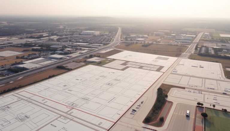
Demystifying the Technology Behind Land Surveying Equipment
Land surveying is key in many fields like construction and mapping. It helps find the exact spots on Earth’s surface. This is done by measuring distance, direction, and height.
Land surveying equipment is crucial for this task. It uses the latest tech for precise measurements. Tools like theodolites and total stations are used.
Knowing how this equipment works is vital. It helps professionals make better choices and succeed in their projects.
Key Takeaways
- Land surveying involves measuring distance, direction, and elevation to determine positions on the Earth’s surface.
- Various equipment is used in land surveying, including theodolites and total stations.
- Understanding land surveying equipment is crucial for professionals in the field.
- Advanced technology is used in land surveying equipment to provide accurate measurements.
- Land surveying is essential in various industries, including construction and infrastructure development.
The Evolution of Land Surveying Technology
The land surveying field has changed a lot over time. Old methods like transit and tape are now replaced by new tech like GPS and drone mapping. This change makes surveying work more accurate and faster.
From Ancient Methods to Modern Digital Solutions
Long ago, surveyors used manual methods like tapes and chains. Then, electronic tools like electronic distance measurement (EDM) devices and total stations came along. Now, they use GPS, LiDAR, and drones to gather data.
- Improved accuracy and reduced manual errors
- Increased efficiency in data collection and processing
- Enhanced capability to survey complex terrains
The Impact of Technology on Surveying Accuracy
Modern tech has made surveying much more accurate. GPS helps find exact spots, and digital levels and total stations give precise measurements. Software also helps by reducing manual errors.

These changes have made surveying results more precise and reliable. As tech keeps getting better, land surveying will likely get even more accurate and efficient.
How Does Land Surveying Equipment Work: Basic Principles
Land surveying equipment works on key principles for accurate measurements and positions. These principles are the base for many surveying technologies.
Fundamental Concepts of Measurement and Positioning
Land surveying equipment uses basic ideas of measurement and positioning. Measurement is about finding distances, angles, and heights between points. Positioning is about finding where these points are on Earth.
Important ideas include:
- Triangulation and trilateration for finding positions
- Angular measurements with theodolites
- Distance measurements with Electronic Distance Measurement (EDM)
These ideas help us understand how surveying equipment gives us precise data.
The Integration of Optics, Electronics, and Software
Today’s land surveying equipment combines optics, electronics, and software for top precision. Optical parts help with precise visual measurements. Electronic parts make data collection faster and more accurate.
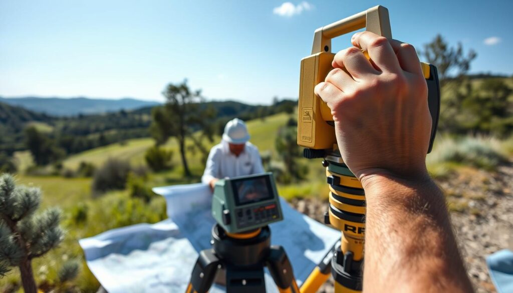
Software is key in handling the data, letting surveyors study and show the results. This mix of technologies has made surveying more efficient and precise.
Some main technologies are:
- Electronic Distance Measurement (EDM)
- Global Navigation Satellite Systems (GNSS)
- Geographic Information Systems (GIS) software
Theodolites: The Cornerstone of Precision Measurement
In land surveying, theodolites are key for precise angle measurements. They help find the space between points, making many survey tasks possible.
The Technology Inside Optical Theodolites
Optical theodolites use telescopes, circles, and leveling systems for angle measurement. Vertical and horizontal circle mechanisms are vital. They allow for exact angle measurements in both planes.
Vertical and Horizontal Circle Mechanisms
The vertical circle measures angles from the telescope to the ground. The horizontal circle measures angles around the vertical axis. These parts are key for accurate data.
Optical Sighting Systems
The optical system, a telescope, targets reference points. It’s essential for precise measurements.
Digital Theodolites: Electronic Components and Functions
Digital theodolites are newer, with electronic parts for better function and accuracy. They have electronic angle measurement systems and can log data. This makes them great for today’s surveying.
How to Set Up and Operate a Theodolite
Setting up a theodolite is important. It involves leveling and centering over a point. Leveling makes sure it’s perfectly horizontal, and centering aligns it with the point.
Leveling and Centering Procedures
To level a theodolite, adjust the tripod and use the leveling system. Centering means moving the instrument until it’s right over the point.
Taking Accurate Angle Measurements
After setup, measure angles by targeting points with the telescope. Record the angles shown on the instrument.
Total Stations: Integration of Multiple Technologies
Total stations have changed land surveying by combining many technologies. They offer high precision and work efficiently. These tools mix electronic theodolites with distance measuring, making them key for surveyors.
Electronic Distance Measurement (EDM) Technology
EDM is a big part of total stations. It lets surveyors measure distances accurately. EDM uses infrared or laser signals to figure out distances by how long it takes for a signal to bounce back.
Infrared and Laser Measurement Systems
EDM uses infrared or laser systems. Infrared systems work best for short distances and are cheaper. Laser systems are more accurate and can measure farther.
Accuracy Factors and Limitations
Many things affect how accurate EDM measurements are. Things like the weather, how well the instrument is set up, and how well the target reflects the signal matter a lot. Knowing these helps get the best results.
Angular Measurement Mechanisms in Total Stations
Total stations also measure angles well. They use electronic encoders to turn angle changes into digital signals. This is important for precise survey data.
Getting angles right is key in surveying. Total stations are made to give accurate angle measurements. This ensures the data collected is reliable.
Step-by-Step Guide to Operating a Total Station
Here’s how to use a total station:
- Setup and initialization: Make sure the total station is level and set right.
- Target sighting: Look through the telescope to find the target.
- Measurement: Start the measurement process, which includes EDM and angle measurements.
- Data recording: Save the data in the instrument or on an external device.
Setup and Initialization Procedures
Setting up a total station right is important. You need to level it and point it in the right direction.
Data Collection and Transfer Techniques
Total stations can gather lots of data, like distances and angles. This data can be sent to computers or other devices through USB or Bluetooth.
By following these steps and knowing about the technologies in total stations, surveyors can work more efficiently and accurately.
Levels and Transit Levels: Ensuring Horizontal Accuracy
The precision of land surveying relies on levels and transit levels. These tools are key for finding height differences between points. This is vital for topographic surveys.
Levels help surveyors measure height differences. They do this by creating a horizontal line of sight. This is thanks to technologies like automatic and digital leveling systems.
Automatic Levels: Self-Leveling Technology Explained
Automatic levels have a compensator. This ensures the line of sight is always horizontal. Even if the instrument is not perfectly level, this tech makes surveying easier and cuts down on mistakes.
Digital Levels: How Electronic Reading Works
Digital levels use electronic sensors to measure height differences. They display these measurements and can store data electronically. This makes it simpler to process and analyze the data.
Transit Levels: Combining Horizontal and Vertical Measurements
Transit levels can measure both horizontal and vertical angles. They are crucial for many surveying tasks. This includes finding property boundaries and setting up construction sites.
Practical Guide to Using Levels for Accurate Readings
To get accurate readings with levels, follow these steps:
- Set up the level on a stable surface.
- Ensure the level is properly calibrated.
- Take multiple readings to verify accuracy.
By following these steps and understanding levels and transit levels technology, surveyors can achieve the accuracy needed in land surveying.
Utility Location Equipment: Seeing What’s Below
Advanced utility location equipment has changed how we find and map underground utilities. It’s key for avoiding damage to hidden infrastructure during digging and building projects.
Ground Penetrating Radar (GPR) Technology
Ground Penetrating Radar (GPR) is a non-destructive way to find underground utilities. It sends radar pulses into the ground and measures the reflections that come back.
How Radar Waves Detect Underground Objects
Radar waves find underground objects by looking for changes in the ground. When a radar pulse hits a buried object, it bounces back to the surface, where it’s caught by a receiver.
Interpreting GPR Data
Understanding GPR data needs skill, as many things can affect the readings. Getting it right is key to knowing where and how deep underground utilities are.
Electromagnetic Locators: Working Principles
Electromagnetic locators are also important for finding utilities. They pick up the electromagnetic fields from conductive underground utilities.
- They work well for finding metallic pipes and cables.
- They can be used in different ways, like active and passive modes.
- How well they work can depend on the soil and other metal objects nearby.
Acoustic Detection Systems for Utility Mapping
Acoustic detection systems send sound waves through the ground. When these waves hit a utility, they bounce back, helping find the utility’s location.
Best Practices for Utility Location Operations
To get accurate utility location, follow these best practices. These include:
- Using a mix of technologies, like GPR and electromagnetic locators.
- Doing a full site check before starting the location work.
- Making sure people know how to use and understand the equipment.
By following these practices and using the latest equipment, we can lower the risk of damaging underground infrastructure.
Precision Measuring Tools in Land Surveying
Accurate land surveying is impossible without precision measuring tools. These tools are key for reliable data in surveying.
Precision measuring tools include EDMs, laser rangefinders, and digital measuring wheels and tapes. Each tool has its own use and benefits in land surveying.
Electronic Distance Meters (EDMs): Technology and Applications
EDMs measure distances between two points with high accuracy. They send a beam of light or infrared radiation to a target. The target reflects it back, and the EDM calculates the distance based on the return time.
EDMs have greatly improved surveying efficiency and accuracy. They are used in topographic surveys and boundary determination.
Laser Rangefinders: How They Calculate Distance
Laser rangefinders use laser technology to measure distances. They send a laser beam to a target and calculate the distance by the time it takes to return.
Laser rangefinders are known for their high accuracy. They are often used in construction and topographic surveys where precision is crucial.
Digital Measuring Wheels and Tapes: Modern Approaches
Digital measuring wheels and tapes are a modern step in measuring technology. They provide accurate measurements easily, with digital displays for clear reading.
Digital measuring wheels are great for measuring in tough terrain. Digital tapes offer flexibility and accuracy in various surveying tasks.
Global Navigation Satellite Systems (GNSS) in Surveying
GNSS technology is key in modern surveying. It lets professionals find exact locations with great accuracy. This tech is vital for many tasks, like building projects and checking the environment.
GPS Receiver Technology and Positioning Calculations
GPS receivers are at the core of GNSS. They use satellite signals to find exact locations. They use data from many satellites to get precise measurements.
Key parts of GPS receivers are special antennas and smart algorithms. These help reduce signal problems and improve data quality.
Real-Time Kinematic (RTK) Systems: Enhanced Precision
RTK systems are a big step up in GNSS. They offer real-time corrections for super-accurate positioning, down to centimeters. This is crucial for tasks needing high precision, like setting up construction sites and marking property lines.
The real-time correction of RTK systems lets surveyors make quick decisions on-site. This makes surveying work much more efficient.
How to Conduct a GNSS Survey
To do a GNSS survey, you start by setting up base and rover gear. The base station is placed at a known spot. It sends corrections to the rover in real-time.
Base and Rover Setup Procedures
Setting up the base and rover needs careful calibration. You pick a good spot for the base station. Then, you set the rover to get corrections from the base.
Data Quality Control Measures
To keep survey data reliable, quality checks are done. You watch signal strength, check for interference, and compare data to known points.
Data Collection and Processing Systems
Land surveying relies on good data collection and processing systems. These systems are key to modern surveying. They help gather, process, and analyze data accurately. New technology has made these systems more efficient and reliable.
Field Data Collectors: Hardware Components
Field data collectors are tough, portable tools for collecting data in different places. They have high-resolution touchscreens and advanced operating systems for surveying software. They also have GPS capabilities for real-time data and location.
Survey Software: Features and Functions
Survey software is vital for data processing. It has many features for analyzing and handling data. It can do complex math, make detailed maps, and manage big datasets. Important features include data visualization tools, automated reporting, and integration with other surveying technologies.
Transferring and Processing Field Data
Transferring and processing field data involves several steps. It starts with downloading data from field devices and ends with analyzing it with survey software. This data is then used to make detailed reports and maps. The speed and accuracy of this process are key for project success. Data transfer protocols and data management practices are crucial for keeping the data reliable and useful.
Maintenance and Calibration of Surveying Equipment
Regular maintenance and calibration are key for surveying equipment to work well. It’s important to keep equipment in top shape for accurate measurements.
Calibration Procedures differ for each surveying tool, but the goal is the same: to get precise readings. For example, theodolites need calibration to measure angles correctly. This means checking and adjusting the instrument’s leveling and alignment.
Regular Calibration Procedures for Different Instruments
Each surveying tool has its own calibration needs. Total stations, for instance, need their EDM technology checked often. This ensures the measured distances match known ones, spotting any errors.
Calibration procedures must follow the maker’s instructions to meet industry standards.
Troubleshooting Common Technical Issues
Even with regular upkeep, technical problems can pop up. Issues like wrong measurements, equipment failure, and software bugs are common. To fix these, start by checking the equipment’s calibration and setup.
Knowing how to tackle these problems helps surveyors keep their gear running smoothly. This way, they can avoid long downtime and ensure their equipment works efficiently.
Conclusion: The Future of Land Surveying Technology
The future of land surveying technology is changing fast. This is thanks to new digital solutions and precise tools. Surveyors now have better equipment, like advanced GNSS systems and data collection software.
It’s important for surveyors to know the basics of surveying technology. This knowledge helps them use new tools and methods. The mix of optics, electronics, and software has made land surveying more accurate. This opens the door for even more innovations.
The need for skilled surveyors will keep growing as new technologies come along. The future of land surveying looks bright. Advances in artificial intelligence and machine learning could change the field even more.
