Land Surveying: Navigating True North vs. Magnetic North
In the field of land surveying, it’s vital to grasp the difference between true north and magnetic north. This knowledge is key for precise measurements and mapping.
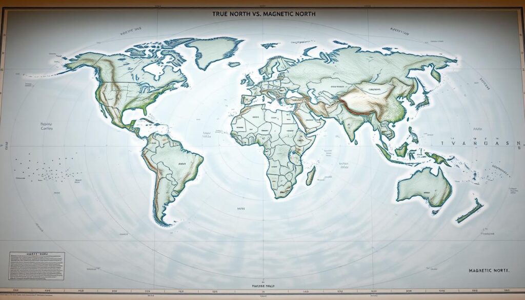
True north, or geographic north, points directly to the geographic North Pole. This is a fixed point on Earth’s surface.
This fixed reference is critical for surveying techniques that demand accuracy and dependability.
Unlike magnetic north, which shifts due to Earth’s magnetic field changes, true north stays the same. This makes it indispensable in land surveying endeavors.
Key Takeaways
- True north is the direction towards the geographic North Pole.
- It is a fixed reference point, unlike magnetic north.
- Understanding true north is crucial for accurate land surveying.
- True north remains constant over time.
- It is essential for precise surveying techniques.
The Foundations of Directional Reference in Surveying
The core of land surveying is pinpointing directional references accurately. This task has seen significant advancements over the years. These references are key to setting up survey orientations. They influence property lines, infrastructure, and map-making.
The Concept of North in Professional Land Surveying
In professional land surveying, “north” is a fundamental directional reference. There are two main “norths”: true north (or geographic north) and magnetic north. It’s crucial to know the difference for precise surveying.
Historical Context of Directional Systems
Surveyors and navigators have employed various methods to find direction. They’ve used the Sun, stars, and compasses influenced by Earth’s magnetic field. Celestial bodies helped find true north early on. Magnetic compasses, though less precise, were more practical.
The Importance of Accurate Directional References
Accurate directional references are vital for survey precision and carry legal weight. Inaccurate references can spark disputes over property lines. They also undermine the integrity of legal documents.
Impact on Survey Precision and Legal Documentation
The accuracy of directional references directly affects survey precision. Inaccurate references can misalign property boundaries, causing legal issues. Legal documents, like property deeds, depend on these references to define property lines.

Surveyors must grasp the historical and legal significance of accurate directional references. This understanding helps them navigate the complexities of true and magnetic north. It enhances the precision and legality of their work.
True North vs. Magnetic North: Understanding the Distinction
Land surveyors must grasp the difference between true north and magnetic north. True north is a fixed geographical reference. Magnetic north, however, changes due to the Earth’s magnetic field variations. This knowledge is key to precise directional measurements in land surveying.
Defining True North (Geographic North)
True north, or geographic north, points towards the Earth’s rotational axis at the North Pole. It remains constant, making it a reliable reference for navigation and surveying.
Earth’s Rotational Axis and the North Pole
The Earth’s rotational axis is an imaginary line through the North and South Poles. True north aligns with this axis, offering a stable directional reference.
Defining Magnetic North
Magnetic north is the compass needle’s direction, influenced by the Earth’s magnetic field. Unlike true north, magnetic north is not fixed and changes over time due to the Earth’s magnetic field variations.
Earth’s Magnetic Field and Its Influence
The Earth’s magnetic field is generated by its outer core’s movements. This field is dynamic, causing magnetic north’s location to shift. The current magnetic north location differs from its historical positions.
Magnetic Declination: The Critical Difference
The difference between true north and magnetic north is magnetic declination. This angle varies by location and is crucial for accurate navigation and surveying.
Regional Variations Across the United States
Magnetic declination varies across the United States. It changes from one region to another, requiring magnetic declination adjustment for precise directional measurements. For instance:
- In the eastern United States, magnetic declination is generally westward.
- In the western United States, it is often eastward.
- The declination angle can range significantly, from a few degrees to over 20 degrees in some areas.

Understanding and adjusting for magnetic declination is essential for surveyors. It ensures their measurements align with true north, maintaining the accuracy of their surveys.
The Critical Role of True North in Land Surveying
In land surveying, true north is a key reference for setting legal boundaries and aligning infrastructure. It’s crucial for the accuracy and reliability of survey data.
Legal Boundaries and Property Delineation
True north is essential for establishing legal boundaries and property lines. Surveyors use it to define property corners accurately.
Deed Descriptions and Monument Placement
Accurate deed descriptions and monument placement are vital for property delineation. Surveyors must reference these elements to true north to prevent disputes and ensure legal compliance.
Infrastructure and Construction Alignment
True north is also crucial for infrastructure and construction alignment. It provides a consistent reference for laying out highways, pipelines, and utility corridors.
Highway, Pipeline, and Utility Corridor Layout
The alignment of these projects requires precise directional referencing. True north ensures they are laid out correctly, reducing errors and ensuring they meet the plan.
Cartographic Applications and GIS Integration
True north is vital for cartographic applications and GIS integration. It offers a common reference frame for mapping and spatial analysis.
Maintaining Spatial Data Accuracy
Maintaining spatial data accuracy is critical for GIS applications. True north ensures spatial data is correctly referenced, enabling precise analysis and decision-making.
Does True North Change Over Time?
True north, often seen as a fixed point, does experience minor changes. These changes, though small, are crucial for precise land surveying and long-term projects.
The Relative Stability of Geographic North
Geographic north, or true north, remains relatively stable due to Earth’s rotational axis. Yet, it is not entirely static.
Earth’s Axial Precession Effects
The Earth’s rotational axis precesses slowly, like a spinning top. This precession causes true north to shift over about 26,000 years. As noted by surveyors, this slow shift is vital for long-term surveys.
Polar Motion and Chandler Wobble
Earth’s axis also wobbles due to its slightly ellipsoidal shape and mass movement. The Chandler Wobble, a small irregularity in Earth’s rotation, adds to the variation in true north.
Measurement and Monitoring Systems
Advanced geodetic systems and monitoring networks track these changes. They provide data for surveyors to adjust their measurements. A recent study found that integrating these systems has greatly improved true north determination accuracy.
“The precise measurement of the Earth’s rotation and axis is crucial for modern surveying techniques.”
Practical Implications for Long-Term Survey Projects
For long-term survey projects, understanding and adjusting for these minor changes is essential. Surveyors must account for precession and polar motion when setting reference points.
Accounting for Minute Changes in Precise Surveys
In precise surveys, even small changes in true north can be significant. Surveyors employ advanced software and data from monitoring systems to compensate for these variations. This ensures the accuracy of their work. Thus, the sophistication of true north finding methods has grown.
The Wandering Magnetic North Pole
The Earth’s magnetic north pole is not fixed; it has been moving. This movement is key to grasping changes in the Earth’s magnetic field. It also affects navigation and surveying.
Historical Movement Patterns Since First Documentation
Since its first observation, the magnetic north pole has been on the move. Initially, it drifted slowly. “The magnetic north pole has been on a journey across the Arctic region, influenced by changes in the Earth’s core.”
Acceleration in Recent Decades
In recent years, the magnetic north pole’s movement has sped up, heading towards Siberia. This shift is critical for navigation systems that depend on the magnetic field.
Current Rate and Direction of Movement
Now, the magnetic north pole is moving at a record-breaking pace. This rapid movement impacts the accuracy of magnetic declination values used in surveying and navigation.
Impact on US Regional Declination Values
The magnetic north pole’s changing position affects declination values in the United States. Surveyors must update their calculations to ensure accuracy.
Forecasting Models and Future Positions
To forecast the magnetic north pole’s future, scientists use models. These models help predict changes in the Earth’s magnetic field.
NOAA and USGS Prediction Resources
NOAA and USGS offer crucial resources and predictions on the magnetic north pole’s future. Their data is essential for surveyors and navigators.
Understanding the magnetic north pole’s movement is vital for precise navigation and surveying.
“The Earth’s magnetic field is dynamic, and its changes have profound implications for how we navigate our world.”
Land Surveying: How to Find True North versus Magnetic North
Determining true north versus magnetic north is a critical task in land surveying. It requires a deep understanding of various reference systems and mathematical conversions. Land surveyors use a range of techniques and tools to accurately make these determinations.
Fundamental Principles of North Determination
Understanding the fundamental principles of north determination is crucial for accurate land surveying. This involves knowledge of reference systems and datums, which serve as the basis for all measurements.
Reference Systems and Datums
Reference systems and datums provide the framework within which land surveys are conducted. These include geographic coordinate systems and vertical datums, which are essential for determining true north.
Mathematical Conversion Between Reference Systems
Converting between different reference systems requires precise magnetic declination adjustment and an understanding of the formulas involved. This ensures that measurements are accurate and consistent across different systems.
Declination Formulas and Calculations
Declination formulas are used to calculate the difference between true north and magnetic north. These calculations are critical for ensuring the accuracy of land surveys.
Common Errors in North Determination
Despite the importance of accurate north determination, several common errors can occur. These include incorrect application of declination formulas and failure to update reference datums.
Troubleshooting and Verification Methods
To mitigate these errors, land surveyors must employ robust troubleshooting and verification methods. This includes cross-checking measurements against known references and using multiple land surveyor tools to validate results.
By understanding the principles of north determination and applying them correctly, land surveyors can ensure the accuracy and reliability of their surveys.
Traditional Methods for Determining True North
The pursuit of precise directional reference has driven the creation of several traditional methods for finding true north. These approaches, while largely outdated by modern technology, hold significant value for grasping the core principles of land surveying.
Solar Observation Techniques
Solar observation techniques rely on measuring the sun’s position to pinpoint true north. This method leverages the sun’s consistent path across the sky.
Equal Altitude (Culmination) Method
The equal altitude method requires measuring the sun’s altitude at two distinct times when it reaches the same height above the horizon. By finding the midpoint between these measurements, surveyors can ascertain true north’s direction.
Solar Ephemeris Tables and Applications
Solar ephemeris tables detail the sun’s position at any specific time and date. Surveyors employ these tables to calculate the sun’s azimuth, thereby determining true north.
Astronomical Observation Methods
Astronomical observations measure celestial bodies’ positions to find true north. This approach is grounded in the predictable movements of stars and constellations.
Polaris Sighting and Star Charts
Polaris, or the North Star, closely aligns with the Earth’s axis, making it a steadfast indicator of true north. Surveyors use Polaris sightings and star charts to determine true north’s direction.
Transit and Theodolite Instrument Procedures
Traditional surveying tools, such as transits and theodolites, are used to measure angles and determine directions. These instruments necessitate precise setup and calibration.
Setting Up and Calibrating Traditional Equipment
To guarantee accuracy, transits and theodolites must be correctly set up and calibrated. This entails leveling the instrument, aligning it with reference points, and making necessary adjustments.
Modern Technology for True North Determination
True north determination has seen a significant leap forward with the advent of advanced technologies in land surveying. Today, land surveyors have access to a variety of cutting-edge tools. These tools significantly improve the accuracy and efficiency of determining true north.
GPS and GNSS Systems in Surveying
The Global Positioning System (GPS) and Global Navigation Satellite System (GNSS) have become crucial in land surveying. They provide precise location and orientation data. This enables surveyors to establish accurate directional references.
RTK and Network Solutions for Orientation
Real-Time Kinematic (RTK) positioning and network solutions enhance GPS/GNSS accuracy by offering real-time corrections. This technology ensures precise orientation and positioning, even in challenging environments.
Digital Compasses and Electronic Theodolites
Digital compasses and electronic theodolites are essential tools for determining true north. These instruments offer high precision and can operate effectively in various environmental conditions.
Gyroscopic Attachments and Inertial Systems
Gyroscopic attachments and inertial systems, when integrated with these instruments, provide additional stability and accuracy. They are particularly useful in situations where traditional methods may be less effective.
Software Solutions and Mobile Applications
Software solutions and mobile applications play a vital role in true north determination. These tools enable surveyors to perform complex calculations and data analysis efficiently.
NOAA Magnetic Field Calculator and Similar Tools
Tools like the NOAA Magnetic Field Calculator are crucial for accurately calculating magnetic declination. This is essential for converting between magnetic and true north. Such software solutions enhance the precision of directional references.
Emerging Technologies in Directional Reference
The field of land surveying is constantly evolving. Emerging technologies promise even greater accuracy and efficiency in true north determination.
Quantum Compasses and Advanced Positioning Systems
Quantum compasses and advanced positioning systems represent the future of directional reference in land surveying. These technologies have the potential to revolutionize the field by offering unprecedented levels of precision.
Step-by-Step Field Guide for Surveyors
Determining true north is a critical task in land surveying. It demands meticulous preparation and the use of precise equipment. Surveyors need the right tools and knowledge to handle the complexities of directional references.
Pre-Field Preparation and Research
Before venturing into the field, surveyors must conduct extensive research and preparation. They should obtain the latest declination values for their area.
Obtaining Current Declination Values for Your Location
Surveyors can find the current magnetic declination for their area through reliable sources. The World Magnetic Model (WMM) and the International Geomagnetic Reference Field (IGRF) models are excellent resources. These models offer accurate declination values, crucial for adjusting measurements to true north.
Field Procedures for True North Determination
In the field, surveyors must adhere to precise procedures to accurately determine true north.
Equipment Setup and Calibration Protocol
The first step is setting up and calibrating equipment. Surveyors must ensure their instruments, like total stations or GPS receivers, are calibrated and configured for accurate measurements.
Measurement and Verification Process
Next, surveyors measure the direction of true north using their calibrated equipment. This may involve astronomical observations or GPS/GNSS systems. It’s vital to verify these measurements through multiple readings for accuracy.
Adjusting for Local Declination in the Field
Adjusting measurements for local magnetic declination is crucial for achieving accurate results.
Manual and Digital Adjustment Techniques
Surveyors can adjust for declination manually or digitally. Manual adjustments involve applying the declination value to the measured magnetic bearing to obtain the true bearing. Digital techniques use software or instrument capabilities for automatic adjustments.
Quality Control and Documentation Practices
Maintaining high-quality documentation is essential for surveyors.
Recording Methods and Data Management
Surveyors should meticulously record their measurements, adjustments, and other relevant data. Proper data management ensures all information is accurately stored and easily retrievable for future reference.
By following this step-by-step guide, surveyors can ensure accurate determinations of true north. This enhances the quality of their land surveying techniques and ensures proper magnetic declination adjustment.
Conclusion: Mastering North Orientation for Accurate Land Surveying
Accurate land surveying hinges on a deep grasp of true north and its difference from magnetic north. It’s essential for surveyors to master north orientation. This ensures they have precise directional references.
Understanding the distinction between true north and magnetic north is critical in land surveying. True north serves as a fixed reference point. On the other hand, magnetic north changes due to shifts in the Earth’s magnetic field.
Surveyors who comprehend true north and magnetic north can accurately mark property boundaries. They can also align infrastructure and integrate data into various systems. This includes cartographic applications and GIS systems.
Land surveying’s success depends on the ability to differentiate between true north and magnetic north. This ensures that survey data remains reliable and accurate.


