Land Surveying Tools: The Essential Gear for Accurate Work
Getting accurate results in land surveying is key. Professional surveyors use top-notch surveying instruments. These tools help measure angles, distances, and heights with great detail.
The right surveying instruments make surveyors’ work better and faster. They need tools like total stations, data collectors, and tripods. Also, prisms and prism poles are very important.
Key Takeaways
- High-quality land surveying equipment is essential for accurate results.
- Surveying instruments such as total stations and data collectors improve efficiency.
- Tripods, prisms, and prism poles are critical components of a surveyor’s toolkit.
- Accurate measurements are crucial for successful land surveying projects.
- Professional surveyors rely on precise equipment to achieve their goals.
The Evolution and Significance of Modern Surveying Equipment
The world of surveying has changed a lot with new tech like GPS and total stations. These tools have made surveys more accurate and faster. This has changed the way surveyors work.
Today’s surveying gear, like GPS surveying tools and total stations, has changed how we collect data. GPS helps find exact locations, and total stations measure distances and angles well. Together, they make surveying easier and quicker.

These modern tools are very important. They make surveys more precise and the data better. For example, laser scanners are now used to get detailed maps of areas.
| Technology | Application | Benefits |
|---|---|---|
| GPS Surveying Tools | Precise location determination | Improved accuracy, reduced time |
| Total Stations | Distance and angle measurements | Enhanced precision, increased efficiency |
| Laser Scanners | Topographic data capture | Detailed information, improved data quality |
These technologies have greatly impacted surveying. Surveyors can now handle big projects with more ease and accuracy. They deliver top-notch results for today’s construction and development needs.
Types of Land Surveying Tools Needed for Professional Fieldwork
For accurate land surveying, the right tools are key. This includes tripods and leveling rods. These tools are vital for precise and reliable survey data. Today’s land surveying equipment uses advanced tech to boost accuracy and speed.
A tripod is essential for keeping surveying tools steady. This is important for precise measurements. Prisms and prism poles are also crucial. Prisms act as reflective targets, and prism poles help with height and target placement.

Leveling rods help find elevation differences on land. They’re key for topographic and construction surveys. Knowing the land’s elevation is crucial for these projects.
Using these tools together, land surveyors can get the accuracy needed for their work. Whether it’s boundary, topographic, or construction surveys, the right land surveying equipment is a must.
Advanced Measurement and Data Collection Instruments
Land surveying has become more precise and efficient with new tools. These advanced instruments have greatly improved surveying accuracy and speed. They are now key for professionals in the field.
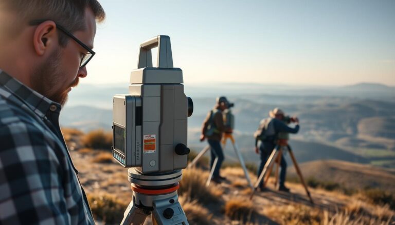
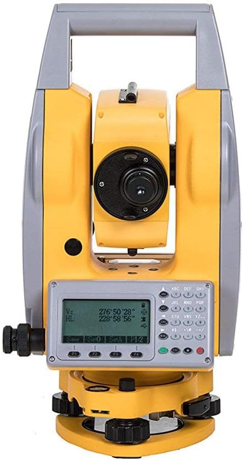
Total Stations: Precision Electronic Distance Measurement
Total stations are vital in modern surveying. They combine a theodolite with electronic distance measurement (EDM) technology. This makes them great for measuring distances, angles, and heights in various surveys.
Key Features and Capabilities
Today’s total stations have advanced features. They offer high-precision EDM, accurate angle measurements, and strong data processing. Some even have automatic target recognition (ATR) and robotic operation for better efficiency.
Key Features:
- High-precision EDM for accurate distance measurements
- Advanced angle measurement capabilities
- Robotic operation for increased efficiency
- Automatic target recognition (ATR)
Applications in Different Surveying Scenarios
Total stations are used in many surveying tasks. They are perfect for boundary, topographic surveys, and construction layout. Their precision and versatility suit both simple and complex projects.
Leading Models and Specifications
Many top brands make high-quality total stations, like Leica Geosystems, Trimble, and Topcon. When choosing, consider accuracy, range, and data processing.
| Model | Measurement Accuracy | Operating Range |
|---|---|---|
| Leica TS60 | 0.5 mm + 1 ppm | Up to 4000 meters |
| Trimble S9 | 0.5 mm + 1 ppm | Up to 5500 meters |
| Topcon IS-3 | 0.8 mm + 1 ppm | Up to 4000 meters |
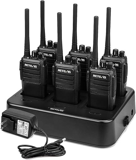
Data Collectors: Digital Field Recording Systems
Data collectors are key for surveyors. They record and store data during surveys. This makes data collection, processing, and transfer efficient.
Software Integration and Functionality
Modern data collectors have integrated software. This software lets surveyors process data, perform calculations, and check for errors. It boosts productivity and cuts down on post-processing needs.
Rugged Design for Field Conditions
Data collectors are built to last in tough field conditions. They handle extreme temperatures, moisture, and physical stress. Their design ensures they work reliably in challenging environments.
Data Processing and Transfer Capabilities
Data collectors make it easy to transfer data to office software. Many models have wireless connectivity. This makes sharing data between devices simple.
GPS and GNSS Surveying Systems
GPS and GNSS systems are crucial for surveying. They use satellites to find precise locations on Earth. This is vital for many surveying tasks.
Advantages of GPS/GNSS Systems:
- High accuracy positioning
- Global coverage
- Ability to work in various weather conditions
GPS and GNSS systems are used in many areas. They are essential for geodetic surveys, construction, and mapping. Their accurate positioning data is invaluable for surveyors.
Essential Support and Positioning Equipment
Support and positioning equipment are key in land surveying. They help keep surveying tools stable and accurate.
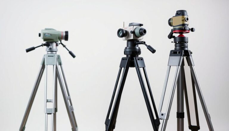
Tripods: Stability Foundations for Precise Measurements
Tripods are the base for most surveying tools. They are vital for getting accurate measurements.
Materials and Construction Quality
The quality of a tripod matters a lot. High-quality land surveying tripods are made from strong materials like aluminum or carbon fiber. They balance weight and strength well.
Height Adjustment and Locking Mechanisms
A good tripod has smooth height adjustment and strong locks. This keeps the surveying tool at the right height.
Maintenance and Field Care
Keeping a tripod in good shape is important. Clean the legs, check the locks, and store it right.
Prisms: Reflective Targets for Distance Measurement
Prisms act as targets for measuring distance in surveying. They are key for Electronic Distance Measurement (EDM) tools.
Types and Accuracy Ratings
There are many types of prisms, each with its own accuracy level. The right prism depends on the survey’s needs.
Mounting Options and Accessories
Prisms can be mounted on tripods or prism poles. Accessories like holders and targets make them more useful.
Proper Handling and Storage
Prisms need to be handled carefully to keep their reflective surface good. Store them in protective cases when not in use.
Prism Poles: Height Control and Target Positioning
Prism poles help place prisms at the right height. This is important for accurate target positioning in surveying.
Telescoping Mechanisms and Height Scales
Prism poles have telescoping parts for adjusting height. Accurate height scales are needed to position the prism correctly.
Bubble Levels and Calibration
Bubble levels on prism poles ensure they are vertical. Regular checks are needed to keep them accurate.
Transport and Field Use
Prism poles are made to be durable and easy to carry. Handle them carefully in the field to avoid damage.
Here’s a comparison of the key features of tripods, prisms, and prism poles:
| Equipment | Primary Function | Key Features |
|---|---|---|
| Tripods | Stability Foundation | Material quality, height adjustment, locking mechanisms |
| Prisms | Reflective Targets | Type, accuracy rating, mounting options |
| Prism Poles | Height Control and Target Positioning | Telescoping mechanism, height scale, bubble level |
Field Tools for Site Preparation and Marking
Land surveying needs the right tools for site prep and marking. These tools help prepare and mark survey sites. This makes sure data is collected and measured accurately.
Brush Axes: Clearing Sightlines and Survey Paths
Brush axes are key for land surveyors. They clear sightlines and paths in dense areas. This is crucial where visibility is hard.
Blade Types and Handles
Brush axes have different blades and handles. The blade type depends on the area’s vegetation. The handle material affects durability and comfort.
Safety Considerations and Proper Use
Surveyors must wear protective gear when using brush axes. They should also be mindful of their surroundings to avoid accidents.
Magnetic Locators (Pin Finders): Detecting Buried Metal Objects
Magnetic locators find buried metal like survey pins. This is key for checking survey points and ensuring accuracy.
Detection Depth and Sensitivity Settings
The success of magnetic locators depends on their depth and sensitivity. Knowing these features is crucial for effective use.
Battery Life and Field Performance
Battery life is important for magnetic locators in the field. Tools need to work for a long time without needing a recharge.
Applications Beyond Property Corners
Magnetic locators are not just for finding property corners. They also find other buried metal that could affect survey measurements.
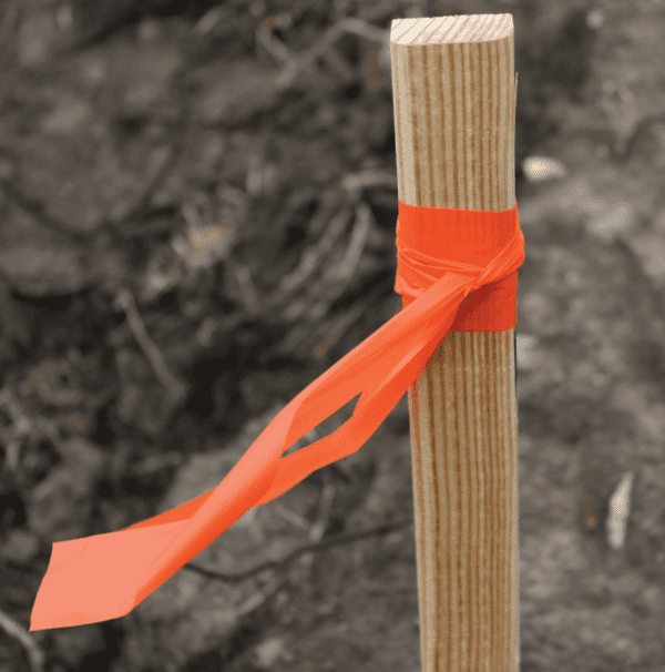
Roll Flagging: Temporary Visual Markers
Roll flagging marks survey points and boundaries temporarily. It’s great for construction and topographic surveys.
PK Nails and Permanent Markers: Establishing Survey Points
PK nails and permanent markers create lasting survey points. These markers are tough and can handle the weather.
Here’s a look at different survey markers:
| Marker Type | Material | Durability | Application |
|---|---|---|---|
| PK Nails | Steel | High | Permanent survey points |
| Roll Flagging | Plastic/Fabric | Low to Medium | Temporary visual markers |
| Magnetic Locators | Electronic Device | Medium to High | Detecting buried metal objects |
Maintenance Protocols for Extending Equipment Lifespan
To keep surveying instruments like total stations and GPS tools working well, regular maintenance is key. These tools are a big investment for surveying work. Taking good care of them helps them keep giving accurate measurements for a long time.
Keeping surveying instruments in top shape involves several important steps. Cleaning is a big part of it. Dirt, dust, and moisture can really hurt how well these tools work. It’s important to clean them right to avoid breaking anything.
Cleaning and Storage Best Practices
Keeping your surveying gear clean and stored right is very important. When you’re not using it, put it in a protective case. This keeps it safe from the weather. Make sure to keep electronic parts like data collectors dry and away from cold or hot places. Also, clean the lenses of total stations and other optical tools often to keep them clear and accurate.
- Use soft, dry cloths for cleaning optical surfaces.
- Store equipment in dry, secure locations.
- Avoid exposing instruments to extreme temperatures.
Calibration Schedules and Procedures
Calibration is also very important for keeping surveying tools in good shape. It makes sure they stay accurate and reliable. Total stations and GPS tools need to be calibrated often to keep their precision. Always follow the maker’s advice on when and how to calibrate to keep things accurate.
- Schedule calibration according to the manufacturer’s recommendations.
- Use certified calibration services.
- Document all calibration activities for future reference.
By following these maintenance steps, surveying experts can make their tools last longer. This means they can keep doing their job accurately and reliably.
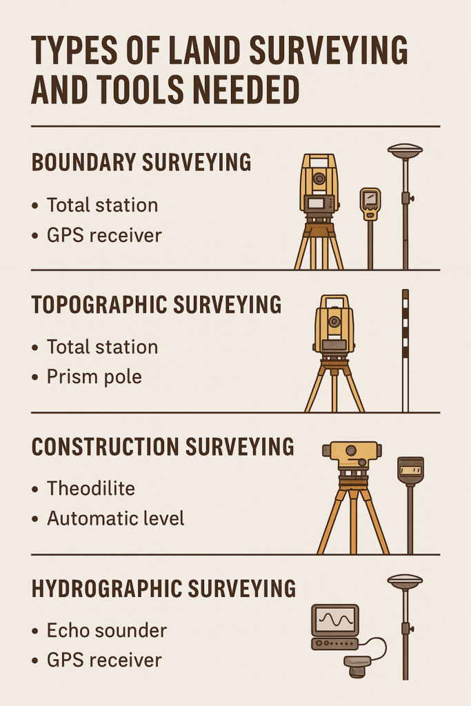
Selecting the Right Tool Combination for Different Survey Projects
Different survey projects need specific tools to get accurate results. The type of survey, its complexity, and the environment matter. Surveyors must pick the right tools for each job.
For example, boundary surveys need different tools than topographic or construction surveys. Knowing these differences helps choose the right tools.
Boundary Surveys: Essential Equipment List
Boundary surveys need precise measurements to find property lines. The key tools include:
- Total stations for precise angle and distance measurements
- Tripods for stability and support
- Prisms for reflecting signals back to the total station
- GPS receivers for georeferencing
Topographic Surveys: Required Tools and Accessories
Topographic surveys map a site’s terrain and features. The needed tools are:
- Laser scanners or total stations for detailed data
- GPS systems for accurate positioning
- Tripods and leveling equipment for stable instruments
- Data collectors for field data recording
Construction Surveys: Specialized Equipment Needs
Construction surveys need tools that can handle a construction site’s demands. Special needs include:
- Robust total stations and GPS systems for tough environments
- Laser levels for site grading
- Sturdy tripods and prism poles for accuracy
Understanding each survey type’s needs helps surveyors choose the best tools. This ensures their projects succeed.
Conclusion: Investing in Quality Surveying Tools for Professional Results
Quality surveying tools are key to getting top results in land surveying. Tools like total stations, data collectors, and tripods make surveys accurate and efficient. They are essential for any surveying job.
GPS surveying tools have changed the game, making data collection fast and precise. Even though it’s old, a prismatic compass still has its uses in certain jobs.
Choosing the right tools for each project is vital. Whether it’s setting boundaries, mapping terrain, or overseeing construction, the right gear is crucial. It ensures the work is done right.
In short, quality surveying tools are the foundation of any successful project. Investing in the best equipment and keeping it in good shape helps surveyors deliver precise results. This boosts their reputation and helps projects succeed.